Tashi Yangtse (Trashi Yangtse)
Trashiyangtse or Tashi Yangtse is a small town in Yangtse Gewog, and the district headquarters of the Trashiyangtse District in eastern Bhutan. It lies inside the Bumdeling Wildlife Sanctuary on the eastern tri-junction of Bhutan-India-China and to the east lies Tawang in India. Nearest airport is Yongphulla Airport 130 km away.
Its population in 2005 was 2735. Located in close proximity to Chorten Kora stupa which lies to the west, a dzong was inaugurated in Trashiyangste in 1997. It contains a major art school, The School of Traditional Arts, also known as Rigne School, which is a sister school of the Zorig Chosum School of Traditional Arts in Thimphu, and teaches six forms of art; painting, pottery, wood sculpture, wood-turning, lacquer-work and embroidery.
* Bhutan–India relations
* Bhutan–India border
* Bhutan–China border
* Line of Actual Control
Map - Tashi Yangtse (Trashi Yangtse)
Map
Country - Bhutan
 |
 |
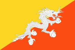
| Flag of Bhutan | |
The subalpine Himalayan mountains in the north rise from the country's lush subtropical plains in the south. In the Bhutanese Himalayas, there are peaks higher than 7000 m above sea level. Gangkhar Puensum is Bhutan's highest peak and is the highest unclimbed mountain in the world. The wildlife of Bhutan is notable for its diversity, including the Himalayan takin and golden langur. The capital and largest city is Thimphu, holding close to 1/7th of the population.
Currency / Language
| ISO | Currency | Symbol | Significant figures |
|---|---|---|---|
| BTN | Bhutanese ngultrum | Nu | 2 |
| INR | Indian rupee | ₹ | 2 |
| ISO | Language |
|---|---|
| DZ | Dzongkha language |


